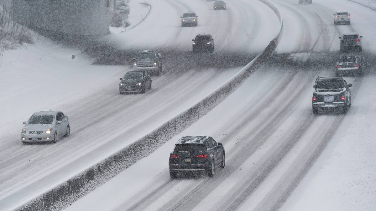
Late April is not when you expect to be digging out, and yet here we are. A heavy wet storm has parked itself over the Northern Rockies, and by sunrise Friday parts of Montana and Wyoming are looking at snow totals closer to February numbers than anything spring should be producing. I-90 is compromised across most of western Montana, while Monida Pass on I-15 is in the same alert. Up on US-212 through Cooke City and US-14 through the Bighorns, the forecast word is whiteout.
The shortest version: if you can wait until afternoon to drive, wait. Most of the worst conditions will have rolled through by then. If that isn't an option, the rest of this is what you're driving into.
Where the Warnings Are Worst
The Gallatin and Madison ranges south of Bozeman are catching the biggest numbers. Snow totals approach 20 inches above 7,500 feet, with valley floors expecting a more modest 3 to 6, and winds gusting to 40 mph. This is the country around Big Sky and West Yellowstone, which means US-191 and US-20 into Yellowstone's western gateway are both compromised, as is Targhee Pass heading into Idaho. The warning runs through Friday noon MDT, and you can track the current status through NWS Great Falls.
East of there, the Absaroka and Beartooth Mountains get hit harder and for longer. That alert holds until 6 p.m. MDT, which matters because Cooke City and the northeast entrance to Yellowstone sit in the middle of it. US-212 climbs over Beartooth Pass, the highest paved road in the region, and it only just reopened for the season. Another 3 to 7 inches is coming at elevation, gusts on the Wyoming side run higher than on the Montana side, and avalanche danger is climbing through the day. NWS Billings is the office to watch here.
The Crazy Mountains sit directly on I-90 between Big Timber and Livingston, and although their warning expires earliest (6 a.m. MDT Friday), it's worth knowing that's the Bozeman-to-Billings stretch of interstate at its most exposed. Further north, up against the Canadian border, the Bears Paw Mountains and Rocky Boy Reservation are under the longest-running alert of the entire event: snow continues there until noon Saturday, with 4 to 9 inches above 4,000 feet and 50 mph gusts.
Over the Wyoming line, the Pryor Mountains and the northern Bighorns are carrying warnings until 6 p.m. MDT Friday. The NWS doesn't bury the message on this one: travel on US-14 through Burgess Junction could be very difficult, with whiteouts likely. If that's your planned route, pick another one.
Yellowstone and the Tetons
The timing here is awkward as Yellowstone is in the middle of its spring road-opening sequence. Crews have been working toward the first full-access weekend, and now this storm is going to push the whole calendar back. NWS Riverton has advisories across the park itself, with Pitchstone Plateau picking up as much as 18 inches.
The Tetons and Gros Ventre are in line for up to 20 inches on the highest peaks and gusts to 50 mph. The Salt River and Wyoming Ranges, further south, see up to 15 inches at elevation. Togwotee Pass on US-26/287 falls inside the same alert zone. Anyone heading into Jackson or Grand Teton this weekend should check nps.gov/yell/planyourvisit/parkroads.htm before committing to a route, because what's open this morning may not be open by Saturday.
Both Interstates at Once
I-90 between Bozeman and Whitehall is under advisory until noon MDT, with 2 to 6 inches expected through Three Forks, Ennis, and Gallatin Gateway. The morning commute window, roughly 7 to 9 a.m. MDT, lands right in the middle of it.
I-15 crosses into the same alert at Monida Pass on the Montana and Idaho border, where 1 to 4 inches is on the way. Monida isn't just any pass: it's the main freight artery between Salt Lake City, Helena, and the Canadian border, and closures or slowdowns there ripple across several states. Homestake Pass on I-90 east of Butte and MacDonald Pass on US-12 are on the same alert.
Western Montana has its own complications. Missoula and the Bitterroot Valley are under advisory through Friday noon for up to 3 inches, locally around 6. Roads that get wet at these elevations freeze quickly. Lookout Pass, where I-90 crosses into Idaho, falls under the same guidance. It's one of the more difficult stretches of I-90 anywhere in the country and a major Seattle-to-Minneapolis freight route. NWS Missoula has the current picture for that side of the state. Livingston, where I-90 meets US-89 heading north into Yellowstone through Gardiner, sees another 1 to 3 inches and 30 mph gusts through Friday noon.
The Passes Between Montana and Idaho
South of I-90, the two main automotive crossings between Montana and Idaho are Lolo Pass on US-12 and Lost Trail Pass on US-93. Both carry advisories until noon MDT Friday, with another 3 to 8 inches coming. Cross into Idaho and the same system is still producing: Highway 28 and the passes around Salmon get anywhere from a few inches in the valleys to more than a foot at elevation, with gusts to 35 mph.
Before You Drive
Most of this clears by Friday afternoon. The Yellowstone and Teton advisories run slightly later, and the Bears Paw warning holds until Saturday noon.
Getty Images
A few practical things. Call 511 in the state you're driving through. Montana (511mt.net), Idaho (511.idaho.gov), and Wyoming (wyoroad.info) all run road condition services, and they're more current than anything else you'll find. Check weather.gov for your specific destination rather than relying on a regional forecast. If your route goes over any of the passes in this story, the simple answer is to leave in the afternoon rather than the morning. Chains go in the vehicle if you're headed toward Big Sky, West Yellowstone, Cooke City, Togwotee Pass, or over US-14 in the Bighorns. One thing worth remembering: all-wheel drive helps you start moving. It does nothing for stopping on ice, and every bridge and overpass in the warning zone is icing over as the wet pavement refreezes.
By Friday afternoon, most of this is over. The weekend looks largely clean outside northern Montana. Getting through Friday morning is the part that takes some thought.


There are no reviews to display.